








By Mercy Matonga:
For years, many developers along the shores of Lake Malawi believed the lake’s shrinking water levels had created permanent room for expansion.
Lodges, hotels, restaurants and farming activities steadily moved closer to the shoreline as investors sought to maximize lakefront space and attract tourists with scenic views.
But the lake’s dramatic return over the past three years has turned what once appeared to be an opportunity into a costly lesson.
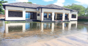
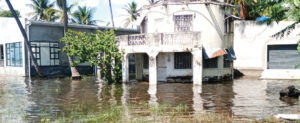
Rising water levels have swallowed parts of beaches, damaged tourism facilities and destroyed farming land in several lakeshore districts, leaving some developers counting massive losses.
- Advertisement -
Tourism Association of Malawi Mangochi Chapter Chairperson Patricia Lunguzi acknowledged the challenges that the tourism sector has faced due to rising water levels, saying the situation has hugely affected businesses and that operators feel unsupported by the government.
“The water has hugely affected businesses; some have even closed, while others have partially closed, but we have not seen any government official coming to appreciate the depth of the challenges that we are currently facing as business operators,” Lunguzi said.
On compliance with the guidelines, Lunguzi said that although some business operators may not have followed the guidelines and the Act, others who conducted proper consultations have also been affected.
“Right now, even the oldest resorts that were built following the proper guidelines have been affected in one way or another, and some have even completely closed,” Lunguzi said.
- Advertisement -
- Advertisement -
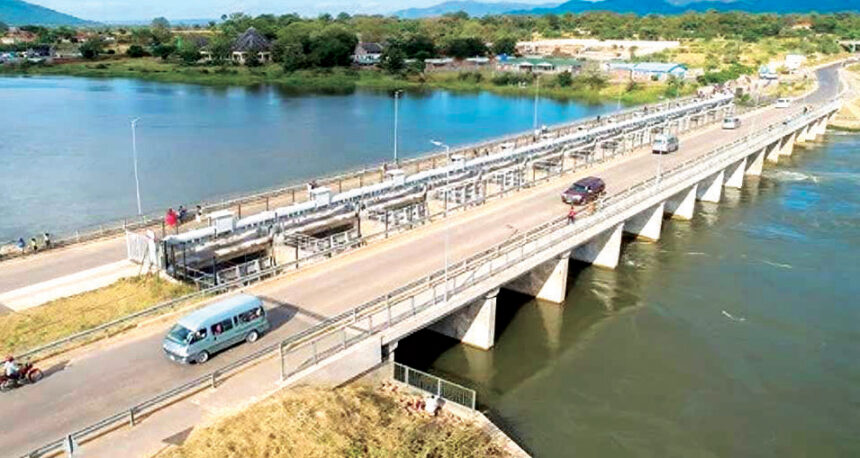
On the control of the Liwonde Barrage, which some argue has contributed to rising water levels in the upper areas because the amount of water passing through the barrage is not enough, Lunguzi said she believes the National Water Resources Authority (NWRA) can do better.
“In the months when we are receiving fewer rains, NWRA can open the barrage so that more water can pass through and relieve the other side,” she said.

On his part, Department of Tourism spokesperson Joseph Nkosi acknowledged that the rising water levels have affected lakeshore hospitality businesses, causing flooding of essential facilities such as guest chalets, dining areas and bars.
“Current assessments conducted by the National Water Resources Authority highlight that many developments were built within zones that are naturally vulnerable to the lake’s fluctuating cycles, below the 477 contour line,” Nkosi said.
He added that the immediate lesson is the importance of respecting this contour line when it comes to tourism developments along the lakeshore and surrounding areas.
“While the immediate damage is severe, the long-term assessment reveals several key shifts in the industry’s development trends.
“We are seeing a move toward stepping back development, where new investments are positioned further inland or on higher ground,” he added.
According to the National Water Resources Authority (NWRA), the rising water levels are largely linked to increased rainfall patterns experienced in recent years.
While the development signals improved water availability for economic and domestic use during the dry season, it has also exposed weaknesses in compliance with environmental and water management regulations.
NWRA spokesperson Masozi Kasambara said the Authority has observed cases of encroachment along vulnerable lakeshore areas, including tourism facilities, private developments, farming activities and other structures established on land exposed during low-water periods that becomes flood-prone when lake levels rise.
He said Section 6 of the Water Resources Act, 2013, declares the beds and banks of lakes and adjacent land strips as public land under the management of the National Water Resources Authority and prohibits unauthorized activities within these areas.
“As such, the 477 metres above sea level (masl) contour should be treated as a flood-risk reference level for development planning, not as a permissible construction limit during low-water years.
“Any development near the lakeshore should therefore be supported by proper surveys, hydrological assessments and approvals from NWRA and other relevant authorities,” Kasambara said.
He added that based on observed daily water-level data, Lake Malawi is expected to remain high during the 2025-26 season. Current data shows a 2025-26 peak of about 476.45 masl and a level of about 476.41 masl recorded on May 7, 2026. This is significantly higher than the same period in 2024-25 and close to the levels observed during the 2023-24 high-water season.
“Flooding remains a credible risk because Lake Malawi is already at a high level, and even a small additional rise can inundate large areas along flat shorelines. The most vulnerable areas include low-lying lakeshores, river mouths, wetlands, beaches, access roads, sanitation facilities and infrastructure located in flood-prone areas,” Kasambara said.
On the control of the Kamuzu Barrage, Kasambara said the structure regulates the outflow of water from Lake Malawi into the Shire River, but it is not the cause of the current rise in lake levels.
He said that the increase is primarily driven by sustained rainfall and high inflows from rivers and catchments feeding into the lake over several consecutive seasons.
“Currently, the barrage is operating at one of its highest release levels in recent years to reduce pressure on the lake. However, releases cannot be increased indefinitely because the Shire River system has a limited carrying capacity,” he said.
According to Kasamba, excessive releases would significantly increase downstream flood risk, particularly to communities, farmland, energy infrastructure, roads, bridges and irrigation schemes in the Lower Shire.
An August 2024 report by National Planning Commission found that rising water levels in Lake Malawi caused K8.9 billion in damages and lost tourism revenue between January and May 2024. Infrastructure damage accounted for K6.4 billion, while K2.5 billion was lost through cancelled tourism activities.
NPC Research called for improved water management systems, protection of economic activities and stricter enforcement of laws against building in flood-prone areas.
The matter of how much water can be allowed downstream remains a critical issue of national importance, but also a complex puzzle due to the competing needs of key sectors such as electricity generation, tourism and agriculture.
Statistics indicate that about 52 percent of the lake’s water comes from Tanzania and 47 percent from Mozambique, a factor that has significantly contributed to the lake reaching critical levels.
Under normal operations, NWRA is expected to release about 330 cubic metres of water per second through the barrage. However, due to increased water levels in the lake, the Authority has at times been forced to release up to 1,000 cubic metres per second to prevent the lake from rising further.
This, however, presents another dilemma. Increasing the volume of water discharged through the barrage raises the risk of flooding downstream, particularly in the Lower Shire, an area already prone to devastating floods that threaten lives, infrastructure, and agricultural land.