








By Patience Lunda:
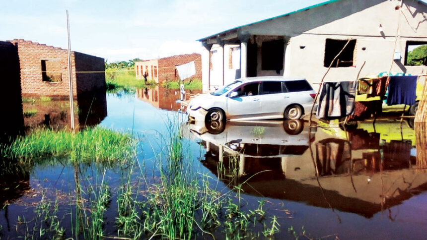
At a time rains are supposed to be receding, the opposite is proving to be true as the Department of Disaster Management Affairs (Dodma) has disclosed that flash floods have created a disaster in five districts.

Dodma spokesperson Chipiliro Khamula has identified the affected districts as Chikwakwa and Mangochi in the Southern Region, Nkhata Bay and Rumphi in the Northern Region and Nkhotakota in the Central Region.
According to Dodma, this far, 1,683 households have been affected by flash floods in traditional authorities Ngabu and Lundu in Chikwawa District.
It indicates that in Nkhotakota and Mangochi, 500 and 118 households, respectively, have been displaced by water.
- Advertisement -
Khamula said assessment exercises are underway to establish the extent of damage in Nkhata Bay and Rumphi districts following flash floods that have affected some places.
Khamula added three people have died while two others have sustained injuries in Chikwawa District.
“The department has already made arrangements for the provision of relief assistance in affected areas but we are calling upon councils to ensure that communities that are at risk have moved to higher and safer areas as a matter of urgency,” he said.
He further revealed that the provision of services in Nkhata Bay District has been interrupted due to high water levels.
- Advertisement -
- Advertisement -
Dodma indicates that some people have vacated their houses due to high water levels and flash floods, which on Friday also negatively affected the provision of services at Chintheche Health Centre as water found its way into patients’ wards and other rooms.
Meanwhile, the Department of Water Resources has said most major rivers in the Northern Region and lakeshore areas are expected to continue experiencing high water levels.
A statement which the ministry released on Friday indicated that this would be the case until April 18 2024, pointing at the risk of flooding.
It added this would be due to heavy rains and thunderstorms that are being experienced in the Northern Region and lakeshore areas.
In total, the rivers that have been cited as likely to flood are 25 and they include North and South Rukuru, Hara, Wovwe, Songwe, Kyungu, Lufilya, Dwambazi and Linthipe.
Meanwhile, environmentalist Charles Bakolo has attributed the situation to natural resource depletion.
“People have destroyed the environment and these are the negative effects.
“However, it is not too late. There is a need for people in the country to be vigilant in planting trees so that we can mitigate some of the impacts of climate change, whose manifestation are the increased cases of floods and dryspells,” he said.
In the 2023-24 rainfall season, the country has been affected by disasters that have included heavy rains and strong winds, killing 17 people this far.
In the month of March, the Department of Climate Change and Meteorological Services warned of a cyclone development.
Although the cyclone failed to fully develop in the country, its formation led to weather changes in some parts of the country.
In recent years, Malawi has been hit by intense tropical cyclones and storms that have included Idai, Freddy, Gombe and Ana, among others, which killed people and livestock and destroyed property.
Last year, the Department of Climate Change and Meteorological Services disclosed that the absence of weather radars was contributing to failure to predict some weather conditions to keep the public well informed.

Weather radars are instruments that support high resolution spatial weather monitoring and are also used for tracking severe weather systems, even in very remote places including mountains and lakes.
According to the department, the equipment can cover a distance of 150 kilometres or more.
Met Director Lucy Mtilatila said at the time that Malawi needed at least three weather radars whose cost is about $2 million (about K2.2 billion) for one set of equipment.
“Weather radars can even estimate the amount of water that will precipitate in the cloud and determine whether it is a normal storm or hailstorm. A weather radar can also estimate the strength of wind as well as provide the route a storm is going to take,” she said.
The country used to have two weather radars at Chileka and Kamuzu international airports but they are worn out.