








By Charles Mpaka:
Rivers broke their banks and the raging waters ripped trees from their roots, mangled bridges from their beams and dredged roads from their foundations.
Mudslides poured from hilltops burying villages and crops.
Rock boulders drummed down from mountains at night crushing houses and people.
When Cyclone Freddy battered Malawi in March this year, it did so with the force that could have been mistaken for an apocalypse of some kind.
- Advertisement -
Three days of incessant rains unleashed a trail destruction not seen in any natural disaster to have hit Malawi in recent memory.
In the chaos and the shock, in the valleys of debris and the sprawling destruction, traditional methods of damage assessment would have hardly been rapid and effective, if at all possible.
Drones to the rescue
But the world is undergoing a revolution in data and image collection; technologies are emerging and they are bettering —if not replacing — man; and Malawi is taking advantage.
- Advertisement -
- Advertisement -
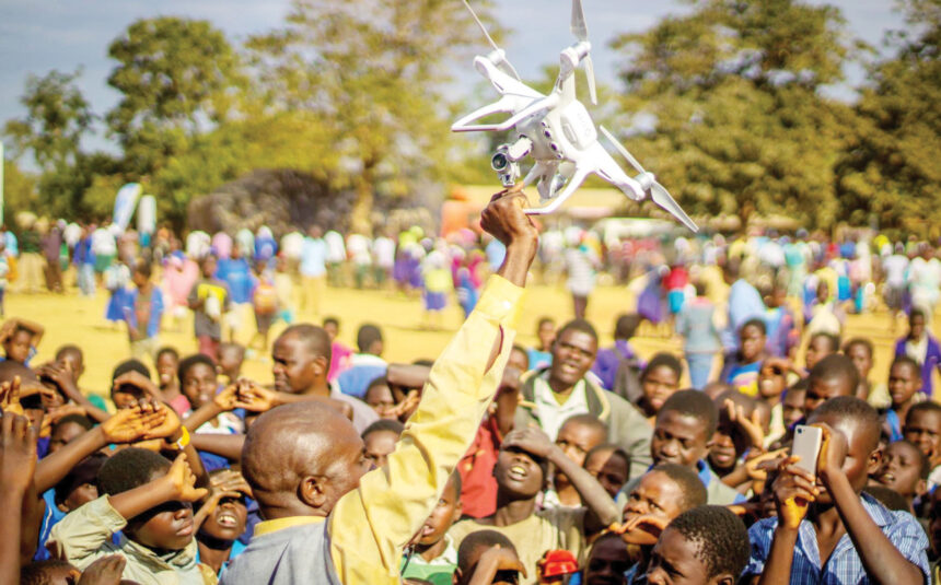
In the case of the cy clone, the Department of Disaster Management Affairs (Dodma) and partners such as Unicef deployed unmanned aerial vehicles (UAVs) above the wasted lands.
With some drones developed to fly as far as 10 kilometres or more from point of launch, the devices would cover nearly every inch of the disaster-hit landscape in real time and more accurately.
As Postar Chikaoneka, Unicef Malawi’s Innovation Programmes Specialist, puts it, drones were dispatched to acquire images and video to ascertain the extent of damage in a manner that would have been impossible through traditional means.
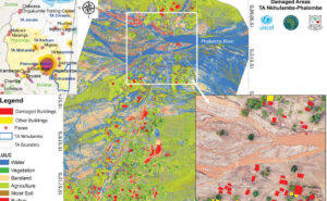
The products of this aerial imagery acquisition were maps of various areas of damage such as infrastructure, crops and roads.
These maps, Chikaoneka explains, are produced by combining satellite imagery with high-definition drone imagery to visually display the damage caused comparing before and after images – a comparison which physical assessment would find it hard to provide, let alone accurately.
“The value of this drone support is in providing up-to-date data that is used f or planning purposes such as transport routes to reach affected communities. This exercise was undertaken over seven days and covered 10 affected districts,” Chikaoneka says.
That data assisted in planning and coordinating response.
Today, six months after the disaster, Dodma is still implementing further recovery interventions such as relocating communities to safer places.
To do this, it is also relying on drones in some respects for efficiency and better results.
Chipiliro Khamula, spokesperson for the department, says Dodma and the district councils are using UAVs in capturing images of land identified for resettlement for further analysis.
Adoption levels

But at what altitude would we say Malawi has gone thus far in adoption of drone technology?
Bram Fudzulani, a member of the UN Internet Governance Forum Multistakeholder Advisory, says drone technology is slowly gaining traction in a number of sectors in Malawi including in agriculture and health.
In healthcare, the UAVs are delivering medical supplies, vaccines and test samples, improving healthcare delivery and emergency response.
In agriculture, drones are being used for crop monitoring, precision agriculture and soil analysis — helping farmers to increase crop yields, reduce resource use and make more informed decisions.
Accelerating adoption
But there is still far more work to do to accelerate adoption and usage, he says.
As the world embraces the Fourth Revolution, the age of total digitalization, Malawi will have to invest significantly in drone technology to tap into its potential for huge impact in various sectors of development such as transportation and environmental monitoring.
“Investing in drone technology can lead to improved efficiency, economic growth, enhanced infrastructure and a host of other benefits that can contribute to a country’s development and prosperity,” he says.
There is also need for Malawi to align its efforts to ensure maximum drone technology usage.
“We need to put in place regulatory framework that provides clear regulations and guidelines for drone usage, including safety, privacy, and airspace management. These regulations should strike a balance between innovation and security,” he says.
He further calls for collaboration among government agencies, private companies and research institutions to promote the innovation and maximize its benefits. This can include joint ventures for research and development or pilot projects.
Developing human capital
To drive this technology, Malawi needs skills – and Unicef is helping to develop the required human capital through the African Drone and Data Academy (Adda) hosted at the Malawi University of Science and Technology (Must).
When Cyclone Freddy hit, Unicef engaged Adda staff and graduates within 24 hours and got them deployed in national response.
Drones are only the medium, Chikaoneka says, and what is most valuable is the data that they produce which require competent analysis for competent decisions.
“Adda graduates are taken through a course that goes beyond operation of drones but also – critically – delves into how they can analyze and package data products in such a way that is indispensable for more robust evidence-based decision making,” he says.
Skills on the ground

Kumwenda
Mclean Kumwenda is one of the graduates of that academy.
He is currently working as an instructor in drone and data technology in that academy.
He prides in a wide range of skills in geospatial analysis, artificial intelligence, data ethics and privacy, drone piloting, design and construction and proficiency in unmanned aircraft regulations.
He was part of the emergency response team during Cyclone Freddy.
In 2021, he contributed to a flood analysis project in the Ndirande Township, predicting households that were at risk of flooding.
He has applied his skills in agriculture and education.
He has participated in a biodiversity project that assessed ecological damage in both protected and unprotected areas in Malawi through the use of drone technology.
“The insights and data we have gathered from this project have proven to be highly valuable for policymakers. They guide decisions on how to effectively conserve and sustain Malawi’s biodiversity,” he says.
But he too outlines a number of challenges that Malawi needs to address to enhance adoption of drone technology.
He says many individuals and industries remain unaware of the advantages of incorporating drones into their operations.
For instance, while drones hold the potential to enhance agricultural practices in Malawi, not all farmers are aware of these possibilities.
Similarly, the potential applications of drones in urban planning have yet to be fully utilised.
“Addressing this issue requires a deliberate effort to raise awareness about the benefits of drone technology and promote its adoption across various sectors,” he says.
He also cites the challenge of affordability associated with drone technology as the “initial investment required for drones is substantial”.
According to Kumwenda, supporting startups within the drone industry can play a role in expanding access to drone technology across Malawi.
This would ensure that a broader section of the population reaps the benefits.
Dodma for drones
For Dodma, in drones, it has found a mechanism for more efficient search and rescue operations when disasters strike.
“We are so committed to utilising the drone technology in implementing various disaster risk management programmes and have been working with various partners in building human capacity with respect to the technology,” Khamula says.